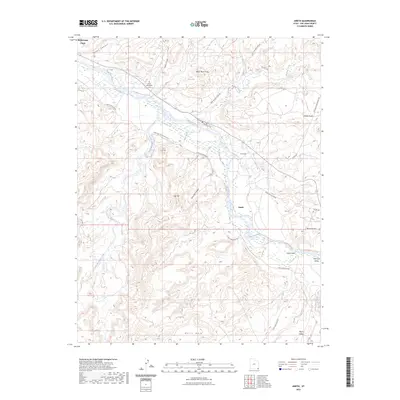
2023 Map of Aneth
USGS Topo · Published 2023About this map
Aneth serves as a central hub in this high-desert landscape, where the San Juan River carves a winding path through the arid terrain of San Juan County. This 2023 edition documents the modern road network connecting remote mesas and valleys, including Ismay Trading Post RD and Indian Rte 352. Notable landmarks like Aneth Point and Black Rock Point define the horizon, while the Aneth Area-Burials Cem indicates a long-standing community presence.
Find a feature on this map
35 named features on this map. Tap any name to fly to it.
Don’t see what you’re looking for? This feature index may not catch every label — zoom into the map to look around manually.
Map Details
Editions of this 2023 Aneth Map
This is the sole edition of this map. No revisions or reprints were ever made.
Other maps of this area

1886 · Abajo
USGS Topo · 1:250,000

1892 · Abajo
USGS Topo · 1:250,000

1893 · Abajo
USGS Topo · 1:250,000

1956 · Cortez
USGS Topo · 1:250,000

1958 · Cortez
USGS Topo · 1:250,000

1958 · Aneth 1 SW
USGS Topo · 1:24,000
1958 · Aneth 1 SE
USGS Topo · 1:24,000

1958 · Cajon Mesa
USGS Topo · 1:62,500

1959 · Cortez
USGS Topo · 1:250,000

1962 · Cortez
USGS Topo · 1:250,000