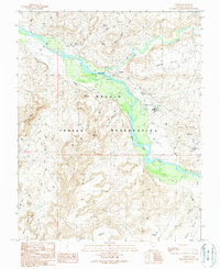
1989 Map of Aneth
USGS Topo · Published 1989About this map
The San Juan River carves through this corner of the Navajo Indian Reservation, defining a landscape where industrial extraction and ancient geography meet. The late 1980s infrastructure of the Aneth Oil Field is documented in detail, showing a network of drill holes and tanks that surround the settlement of Aneth. This resource development is concentrated north of the river, particularly near Aneth Point and along the drainage of McElmo Creek.
Find a feature on this map
20 named features on this map. Tap any name to fly to it.
Don’t see what you’re looking for? This feature index may not catch every label — zoom into the map to look around manually.
Map Details
Editions of this 1989 Aneth Map
This is the sole edition of this map. No revisions or reprints were ever made.
Other maps of this area

1886 · Abajo
USGS Topo · 1:250,000

1892 · Abajo
USGS Topo · 1:250,000

1893 · Abajo
USGS Topo · 1:250,000

1956 · Cortez
USGS Topo · 1:250,000

1958 · Cortez
USGS Topo · 1:250,000

1958 · Aneth 1 SW
USGS Topo · 1:24,000
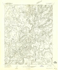
1958 · Aneth 1 SE
USGS Topo · 1:24,000

1958 · Cajon Mesa
USGS Topo · 1:62,500

1959 · Cortez
USGS Topo · 1:250,000

1962 · Cortez
USGS Topo · 1:250,000