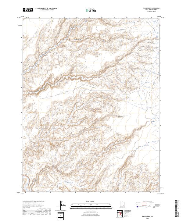
2023 Map of Angel Point
USGS Topo · Published 2023About this map
Robbers Roost Canyon and its many tributaries, including the North Fork, Middle Fork, and South Fork, dominate this portion of Wayne County. The intricate drainage network of the desert plateau is etched into the landscape, leading toward the Dirty Devil River in the southwest corner. Named features such as Angel Point and Bull Pasture indicate historic land use in this arid environment, where water sources like Robbers Roost Spring and Lost Spring were vital for travelers and livestock. This modern survey tracks the limited road network that provides access to the interior, specifically Angel Point Rd and the combined route of Oil Well Rd/Roost House, reflecting the enduring isolation of the San Rafael Desert region.
Find a feature on this map
14 named features on this map. Tap any name to fly to it.
Don’t see what you’re looking for? This feature index may not catch every label — zoom into the map to look around manually.
Map Details
Editions of this 2023 Angel Point Map
This is the sole edition of this map. No revisions or reprints were ever made.
Other maps of this area

1885 · San Rafael
USGS Topo · 1:250,000

1952 · Bull Mountain
USGS Topo · 1:62,500

1953 · Orange Cliffs 3 NE
USGS Topo · 1:24,000

1953 · Orange Cliffs 3 NW
USGS Topo · 1:24,000

1953 · Fiddler Butte
USGS Topo · 1:62,500

1956 · Salina
USGS Topo · 1:250,000

1960 · Salina
USGS Topo · 1:250,000

1962 · Salina
USGS Topo · 1:250,000

1963 · Robbers Roost Canyon
USGS Topo · 1:62,500
1963 · Hanksville
USGS Topo · 1:62,500