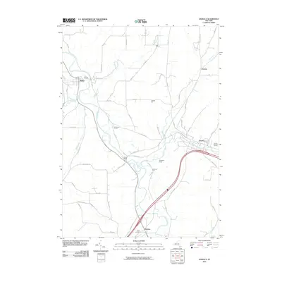
2010 Map of Angelica
USGS Topo · Published 2010About this map
The Genesee River carves a deep valley through this corner of Allegany County, anchoring a landscape defined by riverside settlements and upland farming. Near the northwestern bend, the village of Belfast sits alongside Riverside Cemetery, while the community of Angelica marks the eastern edge of the survey near the poetic Until The Day Dawn Cemetery. The infrastructure here follows the water, with Transit Bridge providing a key crossing point for local traffic moving between the river and the heights of Jacobs Hill. Rural life is centered around family-named crossroads like Aristotle and Belvidere, the latter notable for its proximity to Christ Church Cemetery. This 2010 update shows the persistent arrangement of New York townships, where historic burials like Allen Cemetery and Chamberlain Cemetery remain as quiet landmarks within the sprawling network of county roads and creek valleys such as Wigwam Creek.
Find a feature on this map
65 named features on this map. Tap any name to fly to it.
Don’t see what you’re looking for? This feature index may not catch every label — zoom into the map to look around manually.
Map Details
Editions of this 2010 Angelica Map
This is the sole edition of this map. No revisions or reprints were ever made.
Other maps of this area

1906 · Angelica
USGS Topo · 1:62,500

1916 · Canaseraga
USGS Topo · 1:62,500

1925 · Belmont
USGS Topo · 1:62,500

1926 · Wellsville
USGS Topo · 1:62,500

1939 · Belmont
USGS Topo · 1:62,500

1940 · Canaseraga
USGS Topo · 1:62,500

1941 · Angelica
USGS Topo · 1:62,500

1950 · Elmira
USGS Topo · 1:250,000

1958 · Elmira
USGS Topo · 1:250,000

1960 · Buffalo
USGS Topo · 1:250,000