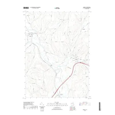
2019 Map of Angelica
USGS Topo · Published 2019About this map
The Genesee River meanders through the heart of Allegany County, carving a valley that has shaped local transportation and settlement for generations. This 2019 survey captures the village of Angelica alongside the winding path of Angelica Creek, showing its historic street grid and several notable local landmarks including the uniquely named Until the Day Dawn Cem. To the west, the village of Belfast sits at the junction of the river and several rural routes like W Hughes St and South St, while the old rail corridor of the P R R follows the waterway south toward Belvidere. Local family history is well-represented through several smaller burying grounds such as Riverside Cem, Chamberlain Cem, and Allen Cem. The landscape transitions from the river flats to the high ground of Jacobs Hill and Peacock Hill, with deep incisions like Nineteen Gully marking the terrain.
Find a feature on this map
86 named features on this map. Tap any name to fly to it.
Don’t see what you’re looking for? This feature index may not catch every label — zoom into the map to look around manually.
Map Details
Editions of this 2019 Angelica Map
This is the sole edition of this map. No revisions or reprints were ever made.
Other maps of this area

1906 · Angelica
USGS Topo · 1:62,500

1916 · Canaseraga
USGS Topo · 1:62,500

1925 · Belmont
USGS Topo · 1:62,500

1926 · Wellsville
USGS Topo · 1:62,500

1939 · Belmont
USGS Topo · 1:62,500

1940 · Canaseraga
USGS Topo · 1:62,500

1941 · Angelica
USGS Topo · 1:62,500

1950 · Elmira
USGS Topo · 1:250,000

1958 · Elmira
USGS Topo · 1:250,000

1960 · Buffalo
USGS Topo · 1:250,000