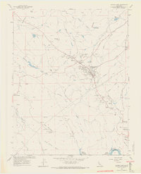
1962 Map of Angels Camp
USGS Topo · Published 1970About this map
Angels Camp serves as the focal point of this Gold Country landscape in the early 1960s, a region defined by its deep mining heritage and rugged drainage systems. The map documents an extensive network of historic mines including the Utica Mine, Gold Cliff Mine, and the Calaveras Central Mine near Altaville. Evidence of the area's cultural history is found at the Romaggi Adobe and the Frogtown fairgrounds, while the industrial infrastructure is represented by the winding Utica Ditch and South Ditch. The terrain is deeply incised by Angels Creek and Cherokee Creek, leading down to the Stanislaus River at the Melones Reservoir. This survey captures the transition from early hard-rock mining to the mid-century development of water resources and transportation, tracing routes like Murphys Grade and Sixmile Road through old settlements like Dogtown and Albany Flat.
Find a feature on this map
71 named features on this map. Tap any name to fly to it.
Don’t see what you’re looking for? This feature index may not catch every label — zoom into the map to look around manually.
Map Details
Editions of this 1962 Angels Camp Map
4 editions found
Other maps of this area

1889 · Jackson
USGS Topo · 1:125,000

1891 · Big Trees
USGS Topo · 1:125,000

1892 · Jackson
USGS Topo · 1:125,000

1893 · Sonora
USGS Topo · 1:125,000

1894 · Big Trees
USGS Topo · 1:125,000

1896 · Sonora
USGS Topo · 1:125,000

1897 · Jackson
USGS Topo · 1:125,000

1897 · Sonora
USGS Topo · 1:125,000

1897 · Big Trees
USGS Topo · 1:125,000

1898 · Sonora
USGS Topo · 1:125,000