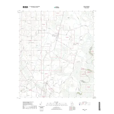
2018 Map of Angie
USGS Topo · Published 2018About this map
Angie and Varnado serve as the primary hubs in this section of Washington Parish, situated near the meandering course of the Pearl River. The landscape is a complex network of wetlands and small water bodies, including Manning Lake, Jones Bayou, and the isolated Morrison Island. This area is particularly dense with family and community burial grounds, offering significant value for genealogical research. Documented sites such as Wesley Ray Cem, Bonnie Cem, and Old Live Oak Cem are scattered throughout the rural countryside, connected by local routes like Balltown Rd and Military Rd. The presence of Old Fornea Cem and Fornea Cem near Varnado suggests deep-rooted local heritage and long-standing settlement patterns in the timber-rich piney woods of southeastern Louisiana.
Find a feature on this map
111 named features on this map. Tap any name to fly to it.
Don’t see what you’re looking for? This feature index may not catch every label — zoom into the map to look around manually.
Map Details
Editions of this 2018 Angie Map
This is the sole edition of this map. No revisions or reprints were ever made.
Other maps of this area

1949 · Bogalusa East
USGS Topo · 1:31,680

1949 · Angie
USGS Topo · 1:31,680

1949 · Bogalusa West
USGS Topo · 1:31,680

1950 · Crains Creek
USGS Topo · 1:31,680

1953 · Hattiesburg
USGS Topo · 1:250,000

1953 · Mobile
USGS Topo · 1:250,000

1957 · Mobile
USGS Topo · 1:250,000

1958 · Hattiesburg
USGS Topo · 1:250,000

1959 · Bogalusa
USGS Topo · 1:62,500

1959 · Poplarville
USGS Topo · 1:62,500