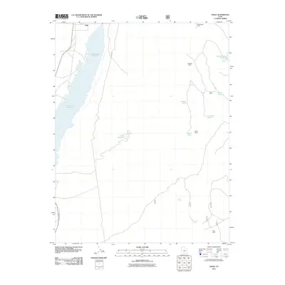
2011 Map of Angle
USGS Topo · Published 2011About this map
Otter Creek Reservoir dominates the western landscape of this high-elevation terrain, a significant water management feature north of Antimony. The settlement of Angle sits at the northern edge of the reservoir, serving as a focal point for the surrounding cattle country. This 2011 survey by the U.S. Geological Survey documents a network of named springs and stock ponds essential for mountain ranching, including Clause Pond and Wood Pond.
Find a feature on this map
18 named features on this map. Tap any name to fly to it.
Don’t see what you’re looking for? This feature index may not catch every label — zoom into the map to look around manually.
Map Details
Editions of this 2011 Angle Map
This is the sole edition of this map. No revisions or reprints were ever made.
Other maps of this area

1885 · Beaver
USGS Topo · 1:250,000

1885 · Fish Lake
USGS Topo · 1:250,000

1896 · Fish Lake
USGS Topo · 1:250,000

1945 · Marysvale
USGS Topo · 1:62,500

1947 · Marysvale
USGS Topo · 1:62,500

1953 · Richfield
USGS Topo · 1:250,000

1956 · Salina
USGS Topo · 1:250,000

1958 · Richfield
USGS Topo · 1:250,000

1960 · Salina
USGS Topo · 1:250,000

1962 · Salina
USGS Topo · 1:250,000