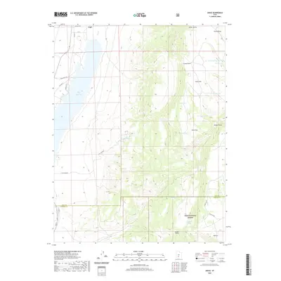
2020 Map of Angle
USGS Topo · Published 2020About this map
Angle serves as the primary focal point of this high-plateau landscape, situated where the valley floor meets the rising slopes of the Awapa Plateau. The geography is defined by the management of water in an arid environment, anchored by the Otter Creek Reservoir and the E Fork Canal which support local agriculture. The transition from the settled valley near Little Meadows to the high elevations of the Dixie National Forest is marked by numerous named springs and livestock-related features, such as Forshea Spring Reservoir and Nicks Pond. The terrain is characterized by steep ascents toward Parker Mtn and transit points like Bedspring Pass, reflecting the area's long history as rangeland. Local routes such as Old Hwy 62 and Forest Rd 445 trace the paths through the draws and hollows that have connected these small communities for generations.
Find a feature on this map
35 named features on this map. Tap any name to fly to it.
Don’t see what you’re looking for? This feature index may not catch every label — zoom into the map to look around manually.
Map Details
Editions of this 2020 Angle Map
This is the sole edition of this map. No revisions or reprints were ever made.
Other maps of this area

1885 · Beaver
USGS Topo · 1:250,000

1885 · Fish Lake
USGS Topo · 1:250,000

1896 · Fish Lake
USGS Topo · 1:250,000

1945 · Marysvale
USGS Topo · 1:62,500

1947 · Marysvale
USGS Topo · 1:62,500

1953 · Richfield
USGS Topo · 1:250,000

1956 · Salina
USGS Topo · 1:250,000

1958 · Richfield
USGS Topo · 1:250,000

1960 · Salina
USGS Topo · 1:250,000

1962 · Salina
USGS Topo · 1:250,000