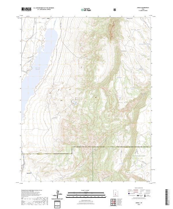
2023 Map of Angle
USGS Topo · Published 2023About this map
Otter Creek Reservoir dominates the western valley of this quadrangle, where the small community of Angle sits near the northern inlet. The landscape transitions sharply from the irrigated lowlands of Little Meadows to the high elevations of the Awapa Plateau and Parker Mtn. The southern portion of the map covers the northern reaches of the Dixie National Forest and the Piute-Garfield county line, which passes through Big Point. Several small bodies of water, including Clause Pond and Nicks Pond, are scattered across the higher terrain, illustrating the high-altitude hydrology of this section of the Sevier River drainage. The settlement of Antimony is located in the southwestern corner, positioned along the old road network that follows the natural contours of the basin floor below Nicks Point.
Find a feature on this map
37 named features on this map. Tap any name to fly to it.
Don’t see what you’re looking for? This feature index may not catch every label — zoom into the map to look around manually.
Map Details
Editions of this 2023 Angle Map
This is the sole edition of this map. No revisions or reprints were ever made.
Other maps of this area

1885 · Beaver
USGS Topo · 1:250,000

1885 · Fish Lake
USGS Topo · 1:250,000

1896 · Fish Lake
USGS Topo · 1:250,000

1945 · Marysvale
USGS Topo · 1:62,500

1947 · Marysvale
USGS Topo · 1:62,500

1953 · Richfield
USGS Topo · 1:250,000

1956 · Salina
USGS Topo · 1:250,000

1958 · Richfield
USGS Topo · 1:250,000

1960 · Salina
USGS Topo · 1:250,000

1962 · Salina
USGS Topo · 1:250,000