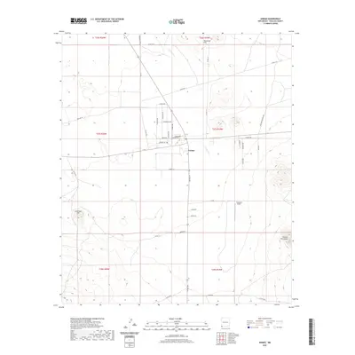
2020 Map of Animas
USGS Topo · Published 2020About this map
Animas sits as the central hub of this high-desert landscape in the southwestern corner of New Mexico. The settlement is positioned near the Animas River, surrounded by a vast network of section roads that provide access to the surrounding ranchlands and mountains. The terrain is defined by dramatic elevations, including the Threemile Hills to the north, Limestone Hill to the west, and the northern reaches of the Animas Mountains in the southeast corner. Transportation and utility infrastructure are prominent features of the area, visible through the Thurmond Airport and the long diagonal of Gas Line Rd. A dense grid of local roads, such as Eldorado Rd and Antelope Crossing Rd, suggests a landscape partitioned for grazing and rural habitation, reflecting the modern agricultural character of Hidalgo County.
Find a feature on this map
41 named features on this map. Tap any name to fly to it.
Don’t see what you’re looking for? This feature index may not catch every label — zoom into the map to look around manually.
Map Details
Editions of this 2020 Animas Map
This is the sole edition of this map. No revisions or reprints were ever made.
Other maps of this area

1918 · Playas
USGS Topo · 1:62,500

1918 · Pratt
USGS Topo · 1:62,500

1919 · Pratt
USGS Topo · 1:62,500

1919 · Playas
USGS Topo · 1:62,500

1954 · Silver City
USGS Topo · 1:250,000

1955 · Douglas
USGS Topo · 1:250,000

1958 · Silver City
USGS Topo · 1:250,000

1959 · Douglas
USGS Topo · 1:250,000

1961 · Douglas
USGS Topo · 1:250,000

1962 · Silver City
USGS Topo · 1:250,000