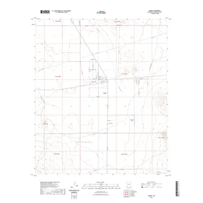
2023 Map of Animas
USGS Topo · Published 2023About this map
Animas sits at the center of this southwestern New Mexico landscape, serving as a hub for the surrounding ranching and agricultural valley. The town's grid of local roads, including Panther Blvd and Hatchet RD, contrasts with the open range of the Animas River valley. To the east, the Animas Mountains rise sharply, while the southern reaches are dominated by the Peloncillo Mountains. A significant marker of local transportation and connectivity is Thurmond Airport, located south of the main settlement near Slover Rd. The map also details a network of rural routes such as Antelope Crossing Rd and Chamisa Rd, which weave through the high desert terrain between notable landmarks like Limestone Hill and the Threemile Hills. This 2023 edition documents the contemporary layout of this borderlands community, where modern infrastructure meets the ancient geographic barriers of the Peloncillo and Animas ranges.
Find a feature on this map
46 named features on this map. Tap any name to fly to it.
Don’t see what you’re looking for? This feature index may not catch every label — zoom into the map to look around manually.
Map Details
Editions of this 2023 Animas Map
This is the sole edition of this map. No revisions or reprints were ever made.
Other maps of this area

1918 · Playas
USGS Topo · 1:62,500

1918 · Pratt
USGS Topo · 1:62,500

1919 · Pratt
USGS Topo · 1:62,500

1919 · Playas
USGS Topo · 1:62,500

1954 · Silver City
USGS Topo · 1:250,000

1955 · Douglas
USGS Topo · 1:250,000

1958 · Silver City
USGS Topo · 1:250,000

1959 · Douglas
USGS Topo · 1:250,000

1961 · Douglas
USGS Topo · 1:250,000

1962 · Silver City
USGS Topo · 1:250,000