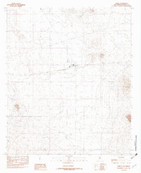
1982 Map of Animas
USGS Topo · Published 1982About this map
Animas sits as the central settlement in this high-desert landscape of southwestern New Mexico, captured during the early 1980s. The geography is defined by volcanic history, with expansive fields of Lava stretching across the western portion of the quadrangle. Transport and infrastructure of the era are clearly marked, from the industrial imprint of an Old R R to a dedicated Landing Strip serving the local ranching or utility needs. To the east, the terrain rises into the Threemile Hills, while the southern edge of the map is dominated by the foothills of the Animas Mountains. Genealogists and local historians will find the small Cem near the town center a valuable point of interest, while the presence of Limestone Hill provides a specific landmark for navigating the varied geological formations that characterize this corner of Hidalgo County.
Find a feature on this map
8 named features on this map. Tap any name to fly to it.
Don’t see what you’re looking for? This feature index may not catch every label — zoom into the map to look around manually.
Map Details
Editions of this 1982 Animas Map
This is the sole edition of this map. No revisions or reprints were ever made.
Other maps of this area

1918 · Playas
USGS Topo · 1:62,500

1918 · Pratt
USGS Topo · 1:62,500

1919 · Pratt
USGS Topo · 1:62,500

1919 · Playas
USGS Topo · 1:62,500

1954 · Silver City
USGS Topo · 1:250,000

1955 · Douglas
USGS Topo · 1:250,000

1958 · Silver City
USGS Topo · 1:250,000

1959 · Douglas
USGS Topo · 1:250,000

1961 · Douglas
USGS Topo · 1:250,000

1962 · Silver City
USGS Topo · 1:250,000