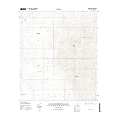
2013 Map of Animas Peak
USGS Topo · Published 2013About this map
Animas Peak dominates the center of this high-desert landscape within the Animas Mountains of Hidalgo County. This arid environment is defined by a sophisticated system of water management features, including several cattle tanks named for local families or locations such as Kings Tank, Echels Tank, and Taylor Tank. The drainage patterns are clearly visible through numerous named draws and canyons, most notably Last Chance Draw and Black Bill Canyon, which funnel seasonal runoff toward Animas Creek. Movement through this territory is marked by historic routes like Co Road C001 and Gray Camp Rd, while Black Bill Spring provides a rare natural water source amidst the ridgelines. The map provides a detailed view of the remote ranching infrastructure and topography before the mid-2010s.
Find a feature on this map
64 named features on this map. Tap any name to fly to it.
Don’t see what you’re looking for? This feature index may not catch every label — zoom into the map to look around manually.
Map Details
Editions of this 2013 Animas Peak Map
This is the sole edition of this map. No revisions or reprints were ever made.
Other maps of this area

1917 · Antelope Wells
USGS Topo · 1:62,500

1918 · Walnut Wells
USGS Topo · 1:62,500

1918 · Cienega Springs
USGS Topo · 1:62,500

1918 · Animas Peak
USGS Topo · 1:62,500

1919 · Antelope Wells
USGS Topo · 1:62,500

1920 · Animas Peak
USGS Topo · 1:62,500

1923 · Walnut Wells
USGS Topo · 1:62,500

1955 · Douglas
USGS Topo · 1:250,000

1959 · Douglas
USGS Topo · 1:250,000

1961 · Douglas
USGS Topo · 1:250,000