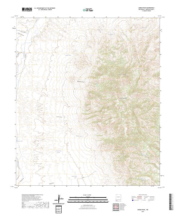
2023 Map of Animas Peak
USGS Topo · Published 2023About this map
Animas Peak dominates the sky in this corner of Hidalgo County, where the high desert meets the northern reach of the Animas Mountains. This high-altitude landscape is defined by its complex network of water management, illustrated by numerous cattle tanks and catchments like Divide Tank, Clanton Tank, and Taylor Tank. These features represent the essential infrastructure of ranching in a desert environment, where every spring and canyon holds significance.
Find a feature on this map
26 named features on this map. Tap any name to fly to it.
Don’t see what you’re looking for? This feature index may not catch every label — zoom into the map to look around manually.
Map Details
Editions of this 2023 Animas Peak Map
This is the sole edition of this map. No revisions or reprints were ever made.
Other maps of this area

1917 · Antelope Wells
USGS Topo · 1:62,500

1918 · Walnut Wells
USGS Topo · 1:62,500

1918 · Cienega Springs
USGS Topo · 1:62,500

1918 · Animas Peak
USGS Topo · 1:62,500

1919 · Antelope Wells
USGS Topo · 1:62,500

1920 · Animas Peak
USGS Topo · 1:62,500

1923 · Walnut Wells
USGS Topo · 1:62,500

1955 · Douglas
USGS Topo · 1:250,000

1959 · Douglas
USGS Topo · 1:250,000

1961 · Douglas
USGS Topo · 1:250,000