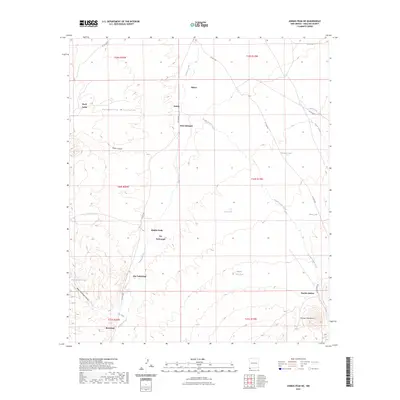
2023 Map of Animas Peak NE
USGS Topo · Published 2023About this map
Animas Creek flows through this corner of Hidalgo County, carving a valley between the Peloncillo Mountains to the west and the Animas Mountains to the southeast. The landscape is defined by its ranching history and remote outposts, with several locations bearing the names of local figures, such as Joe Yarbrough, Abe Yarbrough, and Bene Dunagan. Small, isolated settlements like Birchfield, Eakins, and Spears are connected by a network of unimproved roads including Co RD c001. Water management is essential in this arid terrain, as seen in the distribution of catchments like Dunagan Tank and Middle Well Tank. The geography is further marked by dramatic relief, including Miner Canyon and the steep slopes of Baldy Mountain Canyon, showcasing the traditional desert-upland land use patterns of southwestern New Mexico.
Find a feature on this map
35 named features on this map. Tap any name to fly to it.
Don’t see what you’re looking for? This feature index may not catch every label — zoom into the map to look around manually.
Map Details
Editions of this 2023 Animas Peak NE Map
This is the sole edition of this map. No revisions or reprints were ever made.
Other maps of this area

1918 · Walnut Wells
USGS Topo · 1:62,500

1918 · Playas
USGS Topo · 1:62,500

1918 · Animas Peak
USGS Topo · 1:62,500

1918 · Pratt
USGS Topo · 1:62,500

1919 · Pratt
USGS Topo · 1:62,500

1919 · Playas
USGS Topo · 1:62,500

1920 · Animas Peak
USGS Topo · 1:62,500

1923 · Walnut Wells
USGS Topo · 1:62,500

1955 · Douglas
USGS Topo · 1:250,000

1959 · Douglas
USGS Topo · 1:250,000