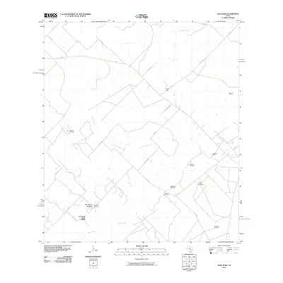
2010 Map of Anna Rose
USGS Topo · Published 2010About this map
La Parrita Valley Colonia and the nearby Rancho de la Parrita characterize the southern reach of this Jim Wells County landscape. The area is defined by its rural ranching and energy production infrastructure, notably the Ramirena Oil Field situated in the northeast. Water management is a primary feature of this arid terrain, marked by several distinct landmarks including the Lagarto Trib Dam and a series of named water sources such as the Lagarto Windmill, Patterson Windmill, and Conejo Windmill.
Find a feature on this map
31 named features on this map. Tap any name to fly to it.
Don’t see what you’re looking for? This feature index may not catch every label — zoom into the map to look around manually.
Map Details
Editions of this 2010 Anna Rose Map
This is the sole edition of this map. No revisions or reprints were ever made.
Other maps of this area

1920 · Mikeska
USGS Topo · 1:125,000

1920 · San Diego
USGS Topo · 1:62,500

1953 · Crystal City
USGS Topo · 1:250,000

1955 · Crystal City
USGS Topo · 1:250,000

1956 · Rosita Ranch
USGS Topo · 1:62,500

1956 · Laredo
USGS Topo · 1:250,000

1961 · Crystal City
USGS Topo · 1:250,000
1963 · Anna Rose
USGS Topo · 1:24,000

1963 · San Diego NE
USGS Topo · 1:24,000
1963 · Crater Ridge
USGS Topo · 1:24,000