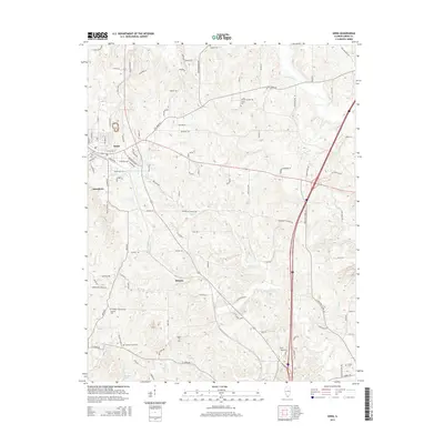
2015 Map of Anna
USGS Topo · Published 2015About this map
Anna and Jonesboro anchor the western edge of this Union County landscape, where the local terrain transitions from the developed streets of these long-established communities into the winding creek valleys of the east. This survey captures a network of rural routes and family landmarks, including several burial grounds like Karaker Cem and Trinity Cem that serve as vital touchstones for genealogists. The drainage pattern is defined by Cypress Cr and the Cache River, which flow through the undulating land north of Balcom. To the south, Keil Airport sits near the junction of major transit corridors, while smaller waterways such as Little Cr and Big Cr carve through the countryside. The map traces the intricate web of local roads, from Old Saratoga to Spanish Bluff Rd, reflecting the persistent rural settlement patterns of Southern Illinois.
Find a feature on this map
105 named features on this map. Tap any name to fly to it.
Don’t see what you’re looking for? This feature index may not catch every label — zoom into the map to look around manually.
Map Details
Editions of this 2015 Anna Map
This is the sole edition of this map. No revisions or reprints were ever made.
Other maps of this area

1920 · Jonesboro
USGS Topo · 1:62,500

1920 · Dongola
USGS Topo · 1:62,500

1922 · Carbondale
USGS Topo · 1:62,500

1923 · Dongola
USGS Topo · 1:62,500

1923 · Jonesboro
USGS Topo · 1:62,500

1924 · Alto Pass
USGS Topo · 1:62,500

1941 · Carbondale
USGS Topo · 1:62,500

1947 · Jonesboro
USGS Topo · 1:62,500

1947 · Alto Pass
USGS Topo · 1:62,500
1947 · Cobden
USGS Topo · 1:24,000