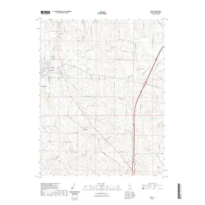
2021 Map of Anna
USGS Topo · Published 2021About this map
Anna and Jonesboro anchor this Union County landscape, where the Illinois Ozark foothills meet the drainage basins of the Cache River and Big Creek. The area is defined by a dense network of country roads named for local families and landmarks, such as Old Saratoga Rd, Barringer School Ln, and Mcduffee Ln. These routes weave through a series of ridges and hollows, connecting smaller settlements like Balcom to the larger population centers.
Find a feature on this map
108 named features on this map. Tap any name to fly to it.
Don’t see what you’re looking for? This feature index may not catch every label — zoom into the map to look around manually.
Map Details
Editions of this 2021 Anna Map
This is the sole edition of this map. No revisions or reprints were ever made.
Other maps of this area

1920 · Jonesboro
USGS Topo · 1:62,500

1920 · Dongola
USGS Topo · 1:62,500

1922 · Carbondale
USGS Topo · 1:62,500

1923 · Dongola
USGS Topo · 1:62,500

1923 · Jonesboro
USGS Topo · 1:62,500

1924 · Alto Pass
USGS Topo · 1:62,500

1941 · Carbondale
USGS Topo · 1:62,500

1947 · Jonesboro
USGS Topo · 1:62,500

1947 · Alto Pass
USGS Topo · 1:62,500
1947 · Cobden
USGS Topo · 1:24,000