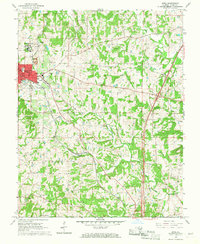
1966 Map of Anna
USGS Topo · Published 1967About this map
Anna State Hospital serves as a major landmark on the northwest edge of Anna, where the town's grid meets the undulating terrain of Union County. The mid-century development of the community is evidenced by the Drive-in Theater and the expansion of residential streets like Lewis Ave and Sheridan St. The Illinois Central railroad remains a primary structural axis, cutting southeast through the landscape toward Balcom.
Find a feature on this map
38 named features on this map. Tap any name to fly to it.
Don’t see what you’re looking for? This feature index may not catch every label — zoom into the map to look around manually.
Map Details
Editions of this 1966 Anna Map
2 editions found
Other maps of this area

1920 · Jonesboro
USGS Topo · 1:62,500

1920 · Dongola
USGS Topo · 1:62,500

1922 · Carbondale
USGS Topo · 1:62,500

1923 · Dongola
USGS Topo · 1:62,500

1923 · Jonesboro
USGS Topo · 1:62,500

1924 · Alto Pass
USGS Topo · 1:62,500

1941 · Carbondale
USGS Topo · 1:62,500

1947 · Jonesboro
USGS Topo · 1:62,500

1947 · Alto Pass
USGS Topo · 1:62,500
1947 · Cobden
USGS Topo · 1:24,000