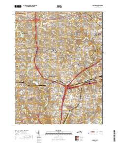
2019 Map of Annandale
USGS Topo · Published 2019About this map
Annandale and its surrounding residential corridors reflect a landscape defined by postwar suburban density and critical transit infrastructure. The area is heavily marked by several named family cemeteries, such as the Summers Family Cem, Broders Family Cem, and Millan Family Cem, which remain as small, localized anchors of genealogical history amidst the modern development of neighborhoods like Canterbury Woods and Kings Park. Centered around the intersection of Columbia Pike and Little River Turnpike, the map showcases a complex network of waterways, including Accotink Cr, which feeds into Lake Accotink. The presence of the Northern Virginia Community College Annandale Campus and the Medical Education Campus underscores the region's role as an educational and institutional hub within Fairfax County.
Find a feature on this map
174 named features on this map. Tap any name to fly to it.
Don’t see what you’re looking for? This feature index may not catch every label — zoom into the map to look around manually.
Map Details
Editions of this 2019 Annandale Map
This is the sole edition of this map. No revisions or reprints were ever made.
Other maps of this area

1890 · Mt. Vernon
USGS Topo · 1:125,000

1891 · Mt. Vernon
USGS Topo · 1:125,000

1894 · Mt. Vernon
USGS Topo · 1:125,000

1897 · Mt. Vernon
USGS Topo · 1:125,000

1900 · Washington
USGS Topo · 1:62,500

1913 · Indian Head
USGS Topo · 1:62,500

1915 · Fairfax
USGS Topo · 1:62,500

1923 · Indian Head
USGS Topo · 1:48,000

1925 · Indian Head
USGS Topo · 1:62,500

1927 · Quantico
USGS Topo · 1:62,500