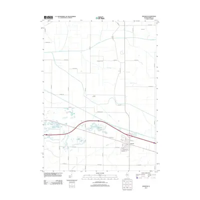
2012 Map of Annawan
USGS Topo · Published 2012About this map
The village of Annawan serves as the primary hub on this Henry County survey, where the local Po and a network of street names like Lathrop St and W Patey St define the settlement's core. The surrounding landscape is characterized by a high-density grid of rural routes, including N 2400th Ave and E 2900th St, which trace the agricultural boundaries of the region. Waterways like the Green River and Mud Cr cut across these fields, influencing the placement of local infrastructure.
Find a feature on this map
42 named features on this map. Tap any name to fly to it.
Don’t see what you’re looking for? This feature index may not catch every label — zoom into the map to look around manually.
Map Details
Editions of this 2012 Annawan Map
This is the sole edition of this map. No revisions or reprints were ever made.
Other maps of this area

1899 · Clinton
USGS Topo · 1:125,000

1929 · Annawan
USGS Topo · 1:62,500

1932 · Prophetstown
USGS Topo · 1:48,000

1932 · Annawan
USGS Topo · 1:62,500

1934 · Geneseo
USGS Topo · 1:62,500

1936 · Prophetstown
USGS Topo · 1:62,500

1952 · Erie
USGS Topo · 1:62,500

1953 · German Corner
USGS Topo · 1:24,000
1953 · Atkinson
USGS Topo · 1:24,000

1958 · Davenport
USGS Topo · 1:250,000