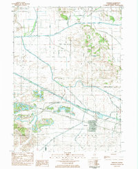
1983 Map of Annawan
USGS Topo · Published 1984About this map
The Annawan village center sits at the heart of this landscape, where the Chicago Rock Island and Pacific Railroad and the Hennepin Canal State Parkway run parallel through the Illinois prairie. The map captures an intricate system of water management, evidenced by the numerous drainage works like Wildcat Ditch, Kuhn Ditch, and Mineral Marsh Ditch that feed into the Green River and Mud Creek. These channels reflect a heavily modified agricultural environment designed to reclaim low-lying lands for cultivation.
Find a feature on this map
35 named features on this map. Tap any name to fly to it.
Don’t see what you’re looking for? This feature index may not catch every label — zoom into the map to look around manually.
Map Details
Editions of this 1983 Annawan Map
This is the sole edition of this map. No revisions or reprints were ever made.
Other maps of this area

1899 · Clinton
USGS Topo · 1:125,000

1929 · Annawan
USGS Topo · 1:62,500

1932 · Prophetstown
USGS Topo · 1:48,000

1932 · Annawan
USGS Topo · 1:62,500

1934 · Geneseo
USGS Topo · 1:62,500

1936 · Prophetstown
USGS Topo · 1:62,500

1952 · Erie
USGS Topo · 1:62,500

1953 · German Corner
USGS Topo · 1:24,000
1953 · Atkinson
USGS Topo · 1:24,000

1958 · Davenport
USGS Topo · 1:250,000