
1947 Map of Anniston
USGS Topo · Published 1953About this map
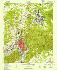
Anniston serves as the industrial and civic anchor of this 1940s landscape, where the concentrated grid of the city meets the expansive operations of the Fort Mc Clellan Military Reservation to the north. The survey documents a post-war military landscape in transition, featuring the Prisoner of War Camp and its associated Prisoner of War Cem, alongside the Reilly Airfield (Abandoned). The intersection of the Louisville and Nashville and Southern railroads defines the western corridor, supporting the city's manufacturing core near Letchers.
Find a feature on this map
78 named features on this map. Tap any name to fly to it.
Don’t see what you’re looking for? This feature index may not catch every label — zoom into the map to look around manually.
Map Details
Editions of this 1947 Anniston Map
2 editions found
Other maps of this area

1900 · Anniston
USGS Topo · 1:125,000

1947 · Oxford
USGS Topo · 1:24,000

1947 · Jacksonville
USGS Topo · 1:24,000

1947 · Wellington
USGS Topo · 1:24,000

1947 · Jacksonville
USGS Topo · 1:62,500

1947 · Eulaton
USGS Topo · 1:24,000

1947 · Munford
USGS Topo · 1:24,000

1950 · Anniston
USGS Topo · 1:62,500

1953 · Atlanta
USGS Topo · 1:250,000

1954 · Choccolocco
USGS Topo · 1:24,000