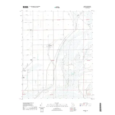
2017 Map of Anniston
USGS Topo · Published 2017About this map
Anniston serves as the central hub of this Mississippi County landscape, where the rectilinear grid of local roads and drainage laterals meets the meandering natural hydrology of the Missouri bootheel. The town, defined by Walnut St and Russell St, is surrounded by a complex system of agricultural water management, including the Wolf Hole Lateral and Spillway Ditch. These man-made channels cut through a terrain once dominated by low-lying wetlands, now evidenced by features like James Bayou and the Ricefield Pond area.
Find a feature on this map
70 named features on this map. Tap any name to fly to it.
Don’t see what you’re looking for? This feature index may not catch every label — zoom into the map to look around manually.
Map Details
Editions of this 2017 Anniston Map
This is the sole edition of this map. No revisions or reprints were ever made.
Other maps of this area

1939 · Wickliffe
USGS Topo · 1:62,500

1939 · Charleston
USGS Topo · 1:62,500

1939 · Hickman
USGS Topo · 1:62,500

1939 · Bayouville
USGS Topo · 1:62,500

1951 · Wolf Island
USGS Topo · 1:24,000

1951 · Wickliffe SW
USGS Topo · 1:24,000

1952 · Wickliffe
USGS Topo · 1:62,500

1954 · Charleston
USGS Topo · 1:62,500

1954 · Hickman
USGS Topo · 1:62,500
1955 · Hickman
USGS Topo · 1:62,500