2021 Map of Anniston
USGS Topo · Published 2021About this map
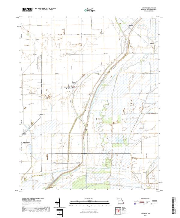
Anniston serves as the central hub of this Mississippi County landscape, where the Anniston Cem and local street networks like Walnut St and Russell St anchor the community. The terrain is defined by an extensive drainage system designed to manage the low-lying wetlands of the Missouri Bootheel, featuring the Birds Point New Madrid Levee Rd which cuts a prominent diagonal across the eastern half. This infrastructure reflects the region's long-term agricultural transformation, converting swampy bottoms into productive land.
Find a feature on this map
66 named features on this map. Tap any name to fly to it.
Don’t see what you’re looking for? This feature index may not catch every label — zoom into the map to look around manually.
Map Details
Editions of this 2021 Anniston Map
This is the sole edition of this map. No revisions or reprints were ever made.