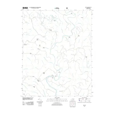
2010 Map of Ano
USGS Topo · Published 2010About this map
The Rockcastle River snakes through this corner of Pulaski County, carving a deep landscape defined by dramatic bends like The Loop and The Narrows. At the turn of the 21st century, the small settlements of Ano and Goodwater remained the primary points of habitation, connected by a network of ridgeline roads such as Bolthouse Ridge Rd and Hindsfield Ridge Rd. For those tracing family histories, the map records several scattered burial sites including Chaney Cemetery and Garrison Cemetery. The southern reaches of the river corridor are dedicated to public use at the Bee Rock Recreation Area, where the Bee Rock Overlook and Bee Rock Ramp provide access to the water. The intricate drainage system is visible through dozens of named hollows and branches, including Salt Log Hollow and the South Prong Bingham Branch.
Find a feature on this map
77 named features on this map. Tap any name to fly to it.
Don’t see what you’re looking for? This feature index may not catch every label — zoom into the map to look around manually.
Map Details
Editions of this 2010 Ano Map
This is the sole edition of this map. No revisions or reprints were ever made.
Other maps of this area

1890 · Williamsburg
USGS Topo · 1:125,000

1893 · London
USGS Topo · 1:125,000

1894 · Williamsburg
USGS Topo · 1:125,000

1897 · London
USGS Topo · 1:125,000

1952 · Hail
USGS Topo · 1:24,000

1952 · London SW
USGS Topo · 1:24,000

1952 · Vox
USGS Topo · 1:24,000

1952 · Billows
USGS Topo · 1:24,000

1952 · Ano
USGS Topo · 1:24,000

1952 · Dykes
USGS Topo · 1:24,000