
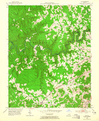
1952 Map of Vox
USGS Topo · Published 1953About this map
The winding Laurel River carves a deep path through this portion of the Cumberland National Forest in Whitley and Laurel counties. In the early 1950s, the landscape was a mosaic of rural settlements and agricultural clearings tucked between heavily wooded ridges. This map reveals a community-centered topography where life revolved around local landmarks like the Gatliff Childrens Home and numerous rural schools including Barton Sch No 1 and Bobtown Sch. The industrial presence of the era is evident in the southeast at the Bacon Strip Mine, indicating the regional reliance on resource extraction. Small clusters like Vox, Keavy, and Tye Town are connected by a network of unimproved dirt roads and the primary routes of KY 312 and KY 727, while the L & N RR provides a critical rail link through the eastern valleys.
Find a feature on this map
57 named features on this map. Tap any name to fly to it.
Don’t see what you’re looking for? This feature index may not catch every label — zoom into the map to look around manually.
Map Details
Editions of this 1952 Vox Map
2 editions found
Other maps of this area

1890 · Williamsburg
USGS Topo · 1:125,000

1893 · London
USGS Topo · 1:125,000

1894 · Williamsburg
USGS Topo · 1:125,000

1897 · London
USGS Topo · 1:125,000

1952 · Corbin
USGS Topo · 1:24,000

1952 · Wofford
USGS Topo · 1:24,000

1952 · Lily
USGS Topo · 1:24,000

1952 · London SW
USGS Topo · 1:24,000

1952 · Ano
USGS Topo · 1:24,000

1952 · Rockholds
USGS Topo · 1:24,000