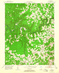
1952 Map of Vox
USGS Topo · Published 1965About this map
The Cumberland National Forest defines the landscape of Whitley and Laurel counties in this mid-century survey, where the winding Cumberland River and Laurel River carve through the timbered terrain. Small rural communities like Vox and Keavy are connected by winding routes such as KY 312, while the southeast corner shows the industrial footprint of the L & N RR and the Bacon Strip Mine. This area is particularly dense with community institutions, featuring a high concentration of country churches and schools that served the dispersed population. Genealogists will find a wealth of specific landmarks including Barton Sch No 2, Steele Chapel, and the Galilean Childrens Home, alongside numerous family-named creeks like Rogers Branch and Watts Creek that speak to the local settlement history of the period.
Find a feature on this map
75 named features on this map. Tap any name to fly to it.
Don’t see what you’re looking for? This feature index may not catch every label — zoom into the map to look around manually.
Map Details
Editions of this 1952 Vox Map
2 editions found
Other maps of this area

1890 · Williamsburg
USGS Topo · 1:125,000

1893 · London
USGS Topo · 1:125,000

1894 · Williamsburg
USGS Topo · 1:125,000

1897 · London
USGS Topo · 1:125,000

1952 · Corbin
USGS Topo · 1:24,000

1952 · Wofford
USGS Topo · 1:24,000

1952 · Lily
USGS Topo · 1:24,000

1952 · London SW
USGS Topo · 1:24,000

1952 · Vox
USGS Topo · 1:24,000

1952 · Ano
USGS Topo · 1:24,000