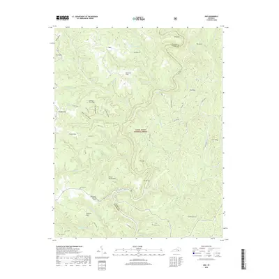
2019 Map of Ano
USGS Topo · Published 2019About this map
The Rockcastle River carves a deep, winding course through the heart of the Daniel Boone National Forest, defining the rugged border between Pulaski and Laurel Counties. This 2019 survey documents a landscape of dramatic river bends and narrow ridges, such as The Narrows and The Loop, where the waterway creates tight horseshoe turns. Small settlements like Ano and Goodwater are situated on the higher elevations, connected by a network of rural roads and ridges including Parkey Ridge and Rockcastle Springs Ridge. Genealogists will find several family burial sites throughout the terrain, including Chaney Cem near the northern boundary and Garrison Cem further south. The topography is defined by intricate drainage systems, with numerous hollows and branches like Salt Log Hollow and Stillhouse Br feeding into the larger creek networks.
Find a feature on this map
76 named features on this map. Tap any name to fly to it.
Don’t see what you’re looking for? This feature index may not catch every label — zoom into the map to look around manually.
Map Details
Editions of this 2019 Ano Map
This is the sole edition of this map. No revisions or reprints were ever made.
Other maps of this area

1890 · Williamsburg
USGS Topo · 1:125,000

1893 · London
USGS Topo · 1:125,000

1894 · Williamsburg
USGS Topo · 1:125,000

1897 · London
USGS Topo · 1:125,000

1952 · Hail
USGS Topo · 1:24,000

1952 · London SW
USGS Topo · 1:24,000

1952 · Vox
USGS Topo · 1:24,000

1952 · Billows
USGS Topo · 1:24,000

1952 · Ano
USGS Topo · 1:24,000

1952 · Dykes
USGS Topo · 1:24,000