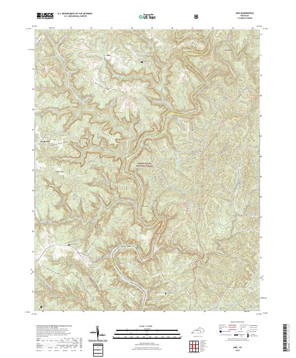
2022 Map of Ano
USGS Topo · Published 2022About this map
Ano and Goodwater anchor the high ground in this section of the Daniel Boone National Forest at the Pulaski and Laurel county line. The landscape is defined by the winding course of the Rockcastle River, which creates distinctive geographical formations such as the Loop, the Narrows, and the Bend. These river features are flanked by sharp ridges, including Bolthouse Ridge and George Barnett Ridge, where small family burial grounds like Chaney Cem and Garrison Cem reflect the area's ancestral settlement patterns. The map documents an extensive network of recreational and historic paths, notably the Sheltowee Trace Trl and Rockcastle River Trl, which provide access to the river's edge and the site of Rockcastle Springs. The convergence of Beech Cr and Lick Cr with the main river channel illustrates the complex drainage system of the Cumberland Plateau.
Find a feature on this map
84 named features on this map. Tap any name to fly to it.
Don’t see what you’re looking for? This feature index may not catch every label — zoom into the map to look around manually.
Map Details
Editions of this 2022 Ano Map
This is the sole edition of this map. No revisions or reprints were ever made.
Other maps of this area

1890 · Williamsburg
USGS Topo · 1:125,000

1893 · London
USGS Topo · 1:125,000

1894 · Williamsburg
USGS Topo · 1:125,000

1897 · London
USGS Topo · 1:125,000

1952 · Hail
USGS Topo · 1:24,000

1952 · London SW
USGS Topo · 1:24,000

1952 · Vox
USGS Topo · 1:24,000

1952 · Billows
USGS Topo · 1:24,000

1952 · Ano
USGS Topo · 1:24,000

1952 · Dykes
USGS Topo · 1:24,000