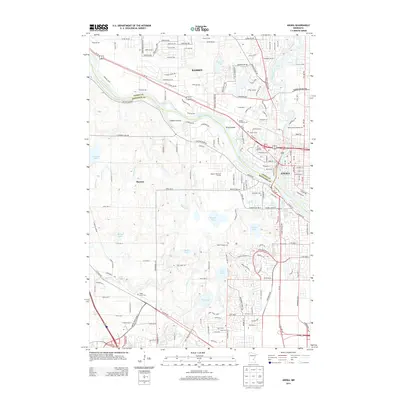
2013 Map of Anoka
USGS Topo · Published 2013About this map
The Mississippi River and Rum River converge at Anoka, shaping the development of this northern Twin Cities landscape during the early 21st century. This survey documents the densely settled areas of Ramsey and Dayton along the river banks, showing a complex network of residential streets and transport corridors like the BNSF Railway. The map is particularly notable for its concentration of cemeteries, including the Anoka State Hospital Cem and Forest Hill Cem, which offer significant value for genealogical research in Anoka Co and Hennepin Co. To the south, the terrain transitions into a more hydrologically diverse area characterized by Goose Lake, Rice Lake, and the winding path of Elm Cr. The inclusion of landmarks such as the Anoka Technical Coll and the Hayden Hills Golf Course provides a clear picture of the community infrastructure and land use patterns of the era.
Find a feature on this map
104 named features on this map. Tap any name to fly to it.
Don’t see what you’re looking for? This feature index may not catch every label — zoom into the map to look around manually.
Map Details
Editions of this 2013 Anoka Map
This is the sole edition of this map. No revisions or reprints were ever made.
Other maps of this area

1902 · Anoka
USGS Topo · 1:62,500

1909 · Rockford
USGS Topo · 1:62,500

1916 · St. Francis
USGS Topo · 1:62,500

1919 · St. Francis
USGS Topo · 1:62,500

1952 · Minneapolis North
USGS Topo · 1:24,000

1953 · Stillwater
USGS Topo · 1:250,000

1955 · Osseo
USGS Topo · 1:24,000

1955 · Anoka
USGS Topo · 1:24,000

1955 · Coon Rapids
USGS Topo · 1:24,000

1955 · Anoka
USGS Topo · 1:62,500