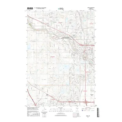
2016 Map of Anoka
USGS Topo · Published 2016About this map
The Mississippi River defines the landscape as it flows between Anoka and Champlin, serving as the centerpiece of the Mississippi National River and Recreation Area. This modern survey details the suburban evolution of the Twin Cities' northern reaches, showing the confluence where the Rum River joins the main channel near the BNSF Railway corridor. The geography is marked by numerous glacial lakes including Hayden Lake, Rice Lake, and Diamond Lake, which dictate the winding paths of roads like Territorial Road and Goose Lake Parkway.
Find a feature on this map
75 named features on this map. Tap any name to fly to it.
Don’t see what you’re looking for? This feature index may not catch every label — zoom into the map to look around manually.
Map Details
Editions of this 2016 Anoka Map
This is the sole edition of this map. No revisions or reprints were ever made.
Other maps of this area

1902 · Anoka
USGS Topo · 1:62,500

1909 · Rockford
USGS Topo · 1:62,500

1916 · St. Francis
USGS Topo · 1:62,500

1919 · St. Francis
USGS Topo · 1:62,500

1952 · Minneapolis North
USGS Topo · 1:24,000

1953 · Stillwater
USGS Topo · 1:250,000

1955 · Osseo
USGS Topo · 1:24,000

1955 · Anoka
USGS Topo · 1:24,000

1955 · Coon Rapids
USGS Topo · 1:24,000

1955 · Anoka
USGS Topo · 1:62,500