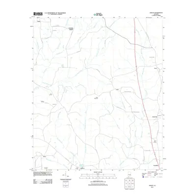
2011 Map of Ansley
USGS Topo · Published 2011About this map
The community of Ansley and the rural hills of Pike County define this 2011 landscape, where the terrain rises to the summit of Becks Mountain. This area is characterized by a dense network of watercourses, including Little Patsaliga Creek, Olustee Creek, and Beeman Creek, which have historically dictated the placement of roads and small settlements like Orion and Curry. The map reveals a deep-rooted social fabric through its numerous rural landmarks, such as the Oak Bowery church and a high concentration of family and community burial grounds including Mount Moriah Cemetery, Springfield Cemetery, and Belsor Cemetery. In the south, the landscape transitions toward Shellhorn and Shellhorn Pond, while the eastern corridor is marked by the presence of Old US Highway 231 passing through Meeksville. This survey serves as a detailed record of the intersections between established agricultural routes and the natural drainage basins of the Alabama coastal plain.
Find a feature on this map
53 named features on this map. Tap any name to fly to it.
Don’t see what you’re looking for? This feature index may not catch every label — zoom into the map to look around manually.
Map Details
Editions of this 2011 Ansley Map
This is the sole edition of this map. No revisions or reprints were ever made.
Other maps of this area

1953 · Montgomery
USGS Topo · 1:250,000

1953 · Andalusia
USGS Topo · 1:250,000

1953 · Dothan
USGS Topo · 1:250,000

1954 · Dothan
USGS Topo · 1:250,000

1955 · Dothan
USGS Topo · 1:250,000

1955 · Phenix City
USGS Topo · 1:250,000

1956 · Montgomery
USGS Topo · 1:250,000

1957 · Phenix City
USGS Topo · 1:250,000

1957 · Montgomery
USGS Topo · 1:250,000

1957 · Andalusia
USGS Topo · 1:250,000