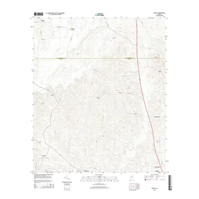
2014 Map of Ansley
USGS Topo · Published 2014About this map
McQuagge Mill Cr and Boulds Mill Cr drain the central highlands of this Alabama landscape, illustrating a terrain defined by narrow ridges and intricate stream networks. The border between Montgomery and Pike counties cuts through the northern third of the map, where the settlement of Orion sits near the historic Orion Cem. This area preserves a high density of rural burial grounds, including Mt Moriah Cem and Sanders Cem, which often represent the locations of former community centers or family homesteads. The Troy Hwy serves as the primary north-south corridor, bypassing smaller locales like Meeksville and Curry. These smaller settlements, along with Ansley and Shellhorn to the south, are linked by a network of county roads that follow the winding geography of the Little Patsaliga Cr and Olustee Cr watersheds.
Find a feature on this map
62 named features on this map. Tap any name to fly to it.
Don’t see what you’re looking for? This feature index may not catch every label — zoom into the map to look around manually.
Map Details
Editions of this 2014 Ansley Map
This is the sole edition of this map. No revisions or reprints were ever made.
Other maps of this area

1953 · Montgomery
USGS Topo · 1:250,000

1953 · Andalusia
USGS Topo · 1:250,000

1953 · Dothan
USGS Topo · 1:250,000

1954 · Dothan
USGS Topo · 1:250,000

1955 · Dothan
USGS Topo · 1:250,000

1955 · Phenix City
USGS Topo · 1:250,000

1956 · Montgomery
USGS Topo · 1:250,000

1957 · Phenix City
USGS Topo · 1:250,000

1957 · Montgomery
USGS Topo · 1:250,000

1957 · Andalusia
USGS Topo · 1:250,000