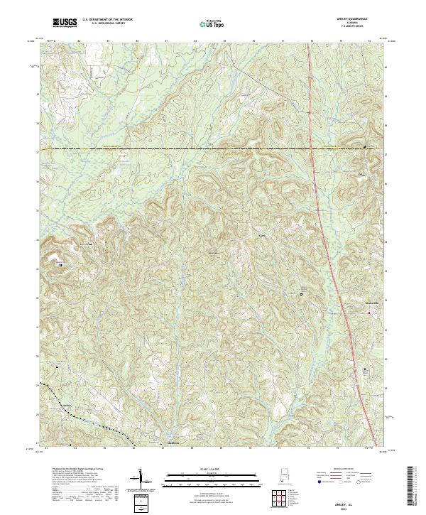
2024 Map of Ansley
USGS Topo · Published 2024About this map
Olustee Creek and Little Patsaliga Creek define the drainage of this rural landscape where the northern boundary of Pike County meets Montgomery County. The map details a network of family-named cemeteries and small crossroads settlements, reflecting a long-standing agricultural social structure. Significant local landmarks such as Becks Mtn rise above the winding watercourses like McQuagge-Mill Creek and Boyds Mill Creek. Genealogists will find a high density of burial sites across this quadrangle, including the Orion Cem near the settlement of Orion and the Pine Grove Cem further west. The arrangement of roads like Old US Hwy 231 and numerous county routes connects these scattered communities, from Meeksville in the east to Ansley and Shellhorn in the south, illustrating the persistent rural connectivity of the region.
Find a feature on this map
77 named features on this map. Tap any name to fly to it.
Don’t see what you’re looking for? This feature index may not catch every label — zoom into the map to look around manually.
Map Details
Editions of this 2024 Ansley Map
This is the sole edition of this map. No revisions or reprints were ever made.
Other maps of this area

1953 · Montgomery
USGS Topo · 1:250,000

1953 · Andalusia
USGS Topo · 1:250,000

1953 · Dothan
USGS Topo · 1:250,000

1954 · Dothan
USGS Topo · 1:250,000

1955 · Dothan
USGS Topo · 1:250,000

1955 · Phenix City
USGS Topo · 1:250,000

1956 · Montgomery
USGS Topo · 1:250,000

1957 · Phenix City
USGS Topo · 1:250,000

1957 · Montgomery
USGS Topo · 1:250,000

1957 · Andalusia
USGS Topo · 1:250,000