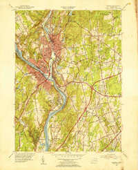
1953 Map of Ansonia
USGS Topo · Published 1955About this map
The Housatonic River and Naugatuck River meet in a sharp industrial and topographic corridor, defining the mid-century development of Ansonia, Derby, and Shelton. This 1953 survey shows the area's dense urban core and surrounding residential expansion into the hills. Notable institutions of the era are clearly marked, including the Laurel Heights State Sanatorium and the Ansonia Airfield. A high concentration of schools and religious sites, such as St Marys Sch and St Michael Cem, suggests a period of established community growth and deep genealogical roots. The landscape is also dotted with critical water management features like Quillinan Reservoir and Wepawaug Reservoir, while the New York New Haven and Hartford railroad tracks trace the riverbanks, illustrating the vital transportation network that fueled these valley towns.
Find a feature on this map
65 named features on this map. Tap any name to fly to it.
Don’t see what you’re looking for? This feature index may not catch every label — zoom into the map to look around manually.
Map Details
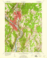
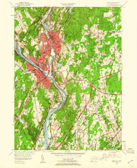
Editions of this 1953 Ansonia Map
3 editions found
Other maps of this area

1889 · Derby
USGS Topo · 1:62,500

1891 · Bridgeport
USGS Topo · 1:62,500

1891 · Derby
USGS Topo · 1:62,500

1892 · New Haven
USGS Topo · 1:62,500

1893 · Bridgeport
USGS Topo · 1:62,500

1893 · Derby
USGS Topo · 1:62,500

1920 · Bridgeport
USGS Topo · 1:62,500

1921 · New Haven
USGS Topo · 1:62,500

1943 · New Haven
USGS Topo · 1:31,680

1943 · Naugatuck
USGS Topo · 1:31,680