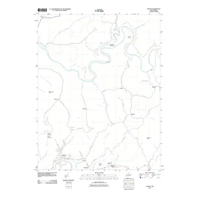
2011 Map of Ansted
USGS Topo · Published 2011About this map
The town of Ansted sits atop the plateau south of the Gauley River, a landscape defined by the deep incisions of water through the West Virginia high country. This modern survey illustrates the proximity of historical centers like Victor and Mountain Cove to the sheer topographic drop-offs of Gauley Mountain. The river itself creates dramatic geographic features such as Koontz Bend and is fed by a complex drainage network including Peters Creek and Laurel Creek. Local landmarks like the Gauley Mountain Lookout Tower and Lee Massey Airport indicate the intersection of traditional fire observation and contemporary transportation. Smaller settlements such as Marvel, Romont, and Ramsey are connected by a web of rural routes like Horseshoe Rd and Rich Creek Rd, reflecting the scattered residential patterns typical of this coal-bearing region. Genealogists may find value in the location of Restlawn Memory Gardens and family-named terrain like Bearwallow Knob and Dogwood Ridge.
Find a feature on this map
60 named features on this map. Tap any name to fly to it.
Don’t see what you’re looking for? This feature index may not catch every label — zoom into the map to look around manually.
Map Details
Editions of this 2011 Ansted Map
This is the sole edition of this map. No revisions or reprints were ever made.
Other maps of this area

1889 · Nicholas
USGS Topo · 1:125,000

1891 · Nicholas
USGS Topo · 1:125,000

1897 · Kanawha Falls
USGS Topo · 1:125,000

1900 · Kanawha Falls
USGS Topo · 1:125,000

1901 · Nicholas
USGS Topo · 1:125,000

1901 · Kanawha Falls
USGS Topo · 1:125,000

1908 · Clay
USGS Topo · 1:48,000

1908 · Fayetteville
USGS Topo · 1:48,000

1910 · Clay
USGS Topo · 1:62,500

1910 · Fayetteville
USGS Topo · 1:62,500