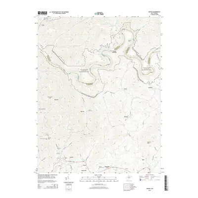
2014 Map of Ansted
USGS Topo · Published 2014About this map
Ansted anchors the southern portion of this landscape, where the plateau drops toward the dramatic canyons of the Gauley River National Recreation Area. The river's path is defined by treacherous whitewater, including Heaven Help You Rapids and Pure Screaming Hell Rapids, winding around distinctive geological features like Koontz Bend. This region serves as a vital corridor between Fayette and Nicholas counties, with small settlements like Victor, Ramsey, and Hico scattered along the high ground of the Midland Trail corridor. Genealogists will find several notable burial sites including Sugar Creek Cem and Restlawn Memory Gardens, while landmarks such as the Gauley Mountain Lookout Tower on Gauley Mtn provide vertical points of reference over the deep hollows of Softwood Hollow and Coal Hollow.
Find a feature on this map
87 named features on this map. Tap any name to fly to it.
Don’t see what you’re looking for? This feature index may not catch every label — zoom into the map to look around manually.
Map Details
Editions of this 2014 Ansted Map
This is the sole edition of this map. No revisions or reprints were ever made.
Other maps of this area

1889 · Nicholas
USGS Topo · 1:125,000

1891 · Nicholas
USGS Topo · 1:125,000

1897 · Kanawha Falls
USGS Topo · 1:125,000

1900 · Kanawha Falls
USGS Topo · 1:125,000

1901 · Nicholas
USGS Topo · 1:125,000

1901 · Kanawha Falls
USGS Topo · 1:125,000

1908 · Clay
USGS Topo · 1:48,000

1908 · Fayetteville
USGS Topo · 1:48,000

1910 · Clay
USGS Topo · 1:62,500

1910 · Fayetteville
USGS Topo · 1:62,500