2023 Map of Ansted
USGS Topo · Published 2023About this map
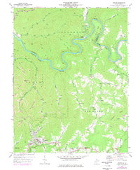
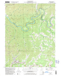
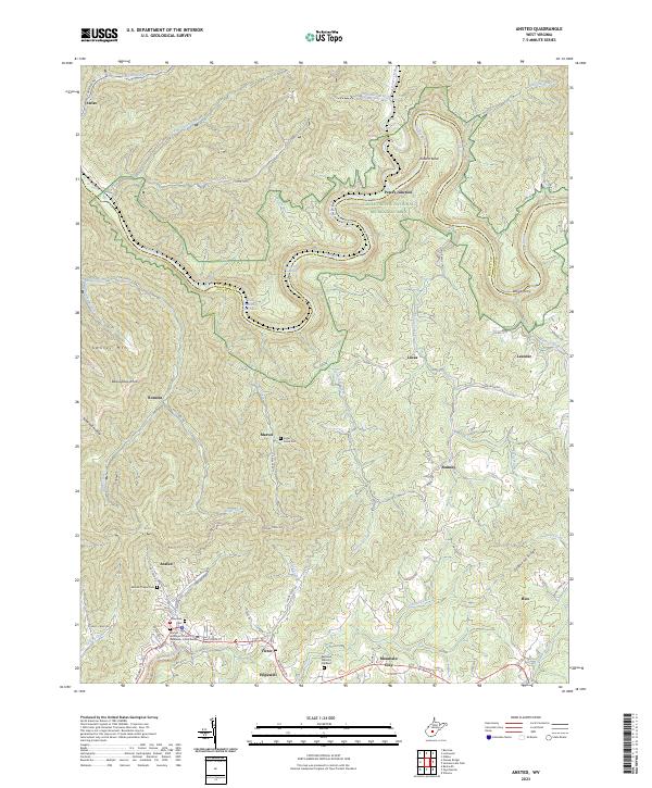
Ansted serves as a primary settlement node in this Fayette County landscape, situated where the high ground of Gauley Mtn meets the deep cuts of the Gauley River gorge. The river corridor is defined by the Gauley River National Recreation Area, where dramatic whitewater features like Pure Screaming Hell Rapids and Heaven Help You Rapids indicate the steep descent of the waterway through the Allegheny Plateau. Historically significant transit points and smaller hamlets such as Marvel, Romont, and Victor are connected by a network of winding roads like Saturday Rd and Coke Oven Rd, reflecting the area's industrial and residential development. Local genealogy is anchored by several burial grounds, including the Ansted Episcopal Church of the Redeemer Columbarium and Mount Chapel Cem, while Woods Ferry points to earlier river-crossing traditions used before modern bridging.
Find a feature on this map
88 named features on this map. Tap any name to fly to it.
Don’t see what you’re looking for? This feature index may not catch every label — zoom into the map to look around manually.
Map Details
Editions of this 2023 Ansted Map
This is the sole edition of this map. No revisions or reprints were ever made.