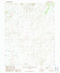
1987 Map of Ant Knoll
USGS Topo · Published 1987About this map
Bullfrog Benches and the high plateaus of Garfield County define this high-desert landscape during the late 1980s. The terrain is dominated by complex geological formations, including Coal Bed Mesa, No Man Mesa, and the prominent Ant Knoll. These features illustrate the erosion patterns of the Colorado Plateau, where drainages like Pennell Creek and Bullfrog Creek have carved deep into the earth.
Find a feature on this map
21 named features on this map. Tap any name to fly to it.
Don’t see what you’re looking for? This feature index may not catch every label — zoom into the map to look around manually.
Map Details
Editions of this 1987 Ant Knoll Map
This is the sole edition of this map. No revisions or reprints were ever made.
Other maps of this area

1886 · Henry Mountains
USGS Topo · 1:250,000

1892 · Henry Mountains
USGS Topo · 1:250,000

1952 · Mt Pennell 1 SW
USGS Topo · 1:24,000

1952 · Mt Pennell 2 NE
USGS Topo · 1:24,000

1952 · Mt Hillers
USGS Topo · 1:62,500

1952 · Mt Pennell 1 NW
USGS Topo · 1:24,000

1953 · Mt Pennell
USGS Topo · 1:62,500

1953 · Mt Pennell 2 SE
USGS Topo · 1:24,000

1953 · Mt Pennell 3 NW
USGS Topo · 1:24,000

1953 · Mt Pennell 2 SW
USGS Topo · 1:24,000