
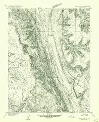
1953 Map of Mt Pennell 2 SW
USGS Topo · Published 1954About this map
Halls Creek and the narrow corridor of Grand Wash define the central topography of this Garfield County interior. Surveyed in the early 1950s, the map documents a transition from the elevated expanse of Swap Mesa in the northwest to the intricate drainages of Butte Canyon in the southeast. A rare human landmark in this isolated landscape is The Post, located where the wash broadens near the base of the mesa. The mapping of Thomson Seep, Muley Tanks, and Cottonwood Tanks highlights the critical importance of reliable water sources for both livestock and travelers in this arid region before modern infrastructure was established. A single Dam is noted in the southern reach, suggesting small-scale water management during this era of post-war topographical survey.
Find a feature on this map
11 named features on this map. Tap any name to fly to it.
Don’t see what you’re looking for? This feature index may not catch every label — zoom into the map to look around manually.
Map Details
Editions of this 1953 Mt Pennell 2 SW Map
This is the sole edition of this map. No revisions or reprints were ever made.
Other maps of this area

1886 · Escalante
USGS Topo · 1:250,000

1886 · Henry Mountains
USGS Topo · 1:250,000

1892 · Henry Mountains
USGS Topo · 1:250,000

1952 · Mt Pennell 2 NE
USGS Topo · 1:24,000

1953 · Mt Pennell
USGS Topo · 1:62,500

1953 · Circle Cliffs 1 SE
USGS Topo · 1:24,000

1953 · Mt Pennell 2 SE
USGS Topo · 1:24,000

1953 · Mt Pennell 3 NW
USGS Topo · 1:24,000
1953 · Circle Cliffs 1 NE
USGS Topo · 1:24,000

1953 · Circle Cliffs 4 NE
USGS Topo · 1:24,000