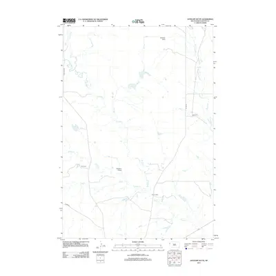
2012 Map of Antelope Butte
USGS Topo · Published 2012About this map
Antelope Butte stands as the primary landmark in this western South Dakota landscape, overlooking a network of ephemeral watercourses and established ranch lands in the early 21st century. The drainage patterns of N Indian Cr and S Indian Cr define the central terrain, eventually merging into Indian Cr as it flows southeast. Local ranching operations, including Davis Ranch, Hoeye Ranch, and Horman Ranch, are the primary markers of human habitation and land use, spaced widely across the open country. These settlements are connected by a sparse road network featuring Camp Crook Rd and Old Hwy 85. The topography is further characterized by distinct features such as Opossum Hollow and the meandering Bull Run, illustrating the sparse but identifiable geographic points of interest in this portion of Butte County.
Find a feature on this map
15 named features on this map. Tap any name to fly to it.
Don’t see what you’re looking for? This feature index may not catch every label — zoom into the map to look around manually.
Map Details
Editions of this 2012 Antelope Butte Map
This is the sole edition of this map. No revisions or reprints were ever made.
Other maps of this area

1905 · Indian
USGS Topo · 1:62,500

1906 · Two Top
USGS Topo · 1:62,500

1907 · Belle Fourche
USGS Topo · 1:125,000

1935 · Harding
USGS Topo · 1:125,000

1953 · Rapid City
USGS Topo · 1:250,000

1954 · Lemmon
USGS Topo · 1:250,000

1957 · Lemmon
USGS Topo · 1:250,000

1957 · Rapid City
USGS Topo · 1:250,000
1965 · Antelope Butte
USGS Topo · 1:24,000
1965 · Two Top Butte West
USGS Topo · 1:24,000