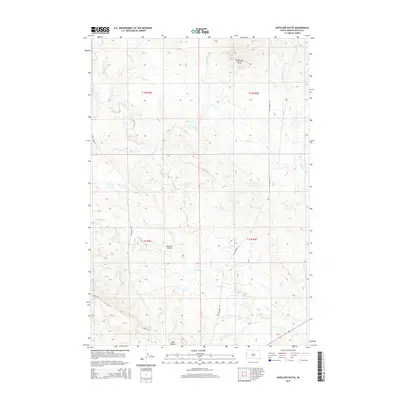
2015 Map of Antelope Butte
USGS Topo · Published 2015About this map
Antelope Butte dominates the northern landscape of this Butte County region, serving as a prominent landmark in an area defined by its complex drainage network. The terrain is carved by numerous seasonal waterways, including the winding courses of S Indian Cr, N Indian Cr, and the main stem of Indian Cr, alongside Bull Run and Porcupine Cr. These creek systems illustrate the natural irrigation patterns essential to this part of South Dakota. Human activity is marked by established transit corridors like Camp Crook Rd and Old Highway 85, which intersect the expansive township and range sections. The presence of Opossum Hollow and the Mud Buttes to the south further characterizes the distinct geological formations of the western plains, offering a detailed look at the rural land use and topographic relief of the mid-2010s.
Find a feature on this map
17 named features on this map. Tap any name to fly to it.
Don’t see what you’re looking for? This feature index may not catch every label — zoom into the map to look around manually.
Map Details
Editions of this 2015 Antelope Butte Map
This is the sole edition of this map. No revisions or reprints were ever made.
Other maps of this area

1905 · Indian
USGS Topo · 1:62,500

1906 · Two Top
USGS Topo · 1:62,500

1907 · Belle Fourche
USGS Topo · 1:125,000

1935 · Harding
USGS Topo · 1:125,000

1953 · Rapid City
USGS Topo · 1:250,000

1954 · Lemmon
USGS Topo · 1:250,000

1957 · Lemmon
USGS Topo · 1:250,000

1957 · Rapid City
USGS Topo · 1:250,000
1965 · Antelope Butte
USGS Topo · 1:24,000
1965 · Two Top Butte West
USGS Topo · 1:24,000