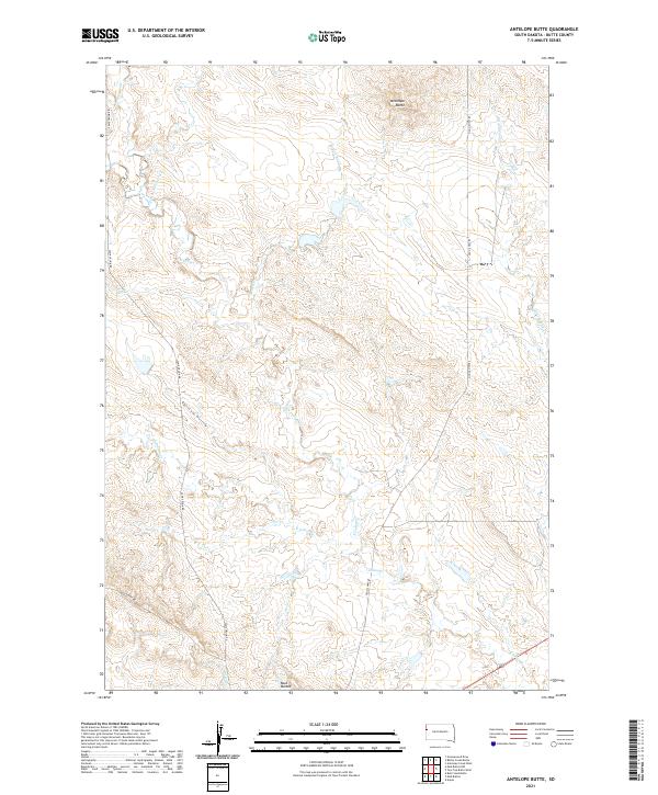
2021 Map of Antelope Butte
USGS Topo · Published 2021About this map
Antelope Butte rises as a prominent landmark in this corner of Butte County, where the high plains are carved by an intricate network of seasonal drainages. The landscape is defined by the hydrologic reach of North Indian Creek and S Indian Cr, which weave through the territory alongside other named waterways like Porcupine Cr and Bull Run. These creek systems create a complex topography of draws and ridges, including the distinct formations of the Mud Buttes and the secluded Opossum Hollow.
Find a feature on this map
19 named features on this map. Tap any name to fly to it.
Don’t see what you’re looking for? This feature index may not catch every label — zoom into the map to look around manually.
Map Details
Editions of this 2021 Antelope Butte Map
This is the sole edition of this map. No revisions or reprints were ever made.
Other maps of this area

1905 · Indian
USGS Topo · 1:62,500

1906 · Two Top
USGS Topo · 1:62,500

1907 · Belle Fourche
USGS Topo · 1:125,000

1935 · Harding
USGS Topo · 1:125,000

1953 · Rapid City
USGS Topo · 1:250,000

1954 · Lemmon
USGS Topo · 1:250,000

1957 · Lemmon
USGS Topo · 1:250,000

1957 · Rapid City
USGS Topo · 1:250,000
1965 · Antelope Butte
USGS Topo · 1:24,000
1965 · Two Top Butte West
USGS Topo · 1:24,000