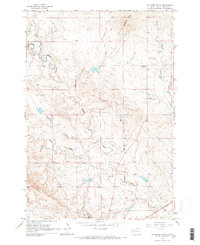
1965 Map of Antelope Butte
USGS Topo · Published 1966About this map
Antelope Butte and the distinctive formations of Mud Buttes anchor this 1960s survey of the rangeland in Butte County. The landscape is defined by a complex drainage network where North Indian Creek, Big Indian Creek, and South Indian Creek converge. This era shows the established footprint of local ranching families, with homesteads such as the Davis Ranch, Horman Ranch, and Hoeye Ranch scattered across the draws and ridges.
Find a feature on this map
18 named features on this map. Tap any name to fly to it.
Don’t see what you’re looking for? This feature index may not catch every label — zoom into the map to look around manually.
Map Details
Editions of this 1965 Antelope Butte Map
2 editions found
Other maps of this area

1905 · Indian
USGS Topo · 1:62,500

1906 · Two Top
USGS Topo · 1:62,500

1907 · Belle Fourche
USGS Topo · 1:125,000

1935 · Harding
USGS Topo · 1:125,000

1953 · Rapid City
USGS Topo · 1:250,000

1954 · Lemmon
USGS Topo · 1:250,000

1957 · Lemmon
USGS Topo · 1:250,000

1957 · Rapid City
USGS Topo · 1:250,000
1965 · Two Top Butte West
USGS Topo · 1:24,000
1965 · Mud Buttes
USGS Topo · 1:24,000