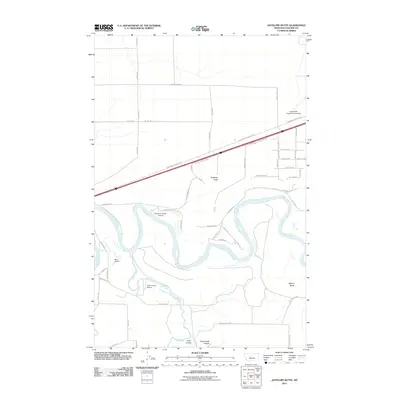
2011 Map of Antelope Butte
USGS Topo · Published 2011About this map
The Missouri River snakes through this landscape southwest of Great Falls, defining a region where river bends and high plateaus meet. The confluence with the Smith River in the southern portion of the map highlights a critical hydrologic junction, surrounded by landforms like Lord Coulee and Cannonball Coulee. This 2011 survey captures a transitional geography where traditional ranching and aviation intersect. Numerous private landing strips, including Buchanan Ranch Airport, Bair Airport, and Smith Farms Airport, dot the plains, reflecting the reliance on small-scale aviation in the Montana interior. Rising above the river valley, prominent landmarks such as Antelope Butte and Wilson Butte serve as natural anchors for local navigation and property boundaries. The presence of Great Falls International Airport at the northeast corner signals the area's role in larger regional transportation networks.
Find a feature on this map
40 named features on this map. Tap any name to fly to it.
Don’t see what you’re looking for? This feature index may not catch every label — zoom into the map to look around manually.
Map Details
Editions of this 2011 Antelope Butte Map
This is the sole edition of this map. No revisions or reprints were ever made.
Other maps of this area

1886 · Great Falls
USGS Topo · 1:250,000

1949 · Cascade
USGS Topo · 1:62,500

1949 · Great Falls
USGS Topo · 1:62,500

1949 · Vaughn
USGS Topo · 1:62,500

1951 · Great Falls
USGS Topo · 1:62,500

1951 · Cascade
USGS Topo · 1:62,500

1952 · Vaughn
USGS Topo · 1:62,500

1954 · Great Falls
USGS Topo · 1:250,000

1955 · Gore Hill
USGS Topo · 1:62,500

1957 · Great Falls
USGS Topo · 1:250,000