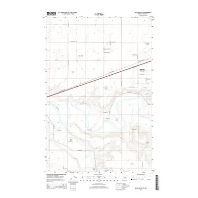
2014 Map of Antelope Butte
USGS Topo · Published 2014About this map
Great Falls and the settlement of Ulm define this landscape where the Missouri River meets the winding Smith River. The map details a transition from the urban periphery of Great Falls, characterized by the Great Falls International Airport and suburban roads like 57th Ave SW, to the expansive elevated terrain of Sun River Bench and Truly Bench. Several smaller airstrips, including Bair Airport and Smith Farms Airport, are scattered across the plains, reflecting the region's aviation-dependent transport network. To the south, the topography becomes more varied, marked by prominent landmarks such as Antelope Butte and Wilson Butte, and intersected by drainages like Lord Coulee and Cannonball Coulee. This survey provides a precise view of the local road grid, from major routes like Ulm N Frontage Rd to isolated tracks serving the rural benchlands.
Find a feature on this map
49 named features on this map. Tap any name to fly to it.
Don’t see what you’re looking for? This feature index may not catch every label — zoom into the map to look around manually.
Map Details
Editions of this 2014 Antelope Butte Map
This is the sole edition of this map. No revisions or reprints were ever made.
Other maps of this area

1886 · Great Falls
USGS Topo · 1:250,000

1949 · Cascade
USGS Topo · 1:62,500

1949 · Great Falls
USGS Topo · 1:62,500

1949 · Vaughn
USGS Topo · 1:62,500

1951 · Great Falls
USGS Topo · 1:62,500

1951 · Cascade
USGS Topo · 1:62,500

1952 · Vaughn
USGS Topo · 1:62,500

1954 · Great Falls
USGS Topo · 1:250,000

1955 · Gore Hill
USGS Topo · 1:62,500

1957 · Great Falls
USGS Topo · 1:250,000