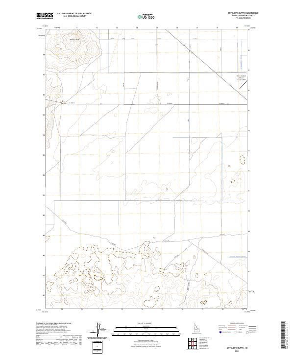
2024 Map of Antelope Butte
USGS Topo · Published 2024About this map
Antelope Butte rises as a prominent landmark in the northwestern corner of this high-desert landscape in Jefferson County. The map documents a strictly organized grid of Public Land Survey System township and range lines, reflecting the region's agricultural and aviation infrastructure. A specialized network of irrigation channels, including the Crystal Lake Canal and Second Owsley Canal, underscores the engineering required to sustain this arid terrain. Transportation in the area is anchored by the Mud Lake/West Jefferson County Airport in the northeast, while a system of rural routes like Schwendig Rd and W Mud Lake Rd connects the scattered homesteads and fields. The presence of numerous canals and access roads such as Canal Rd highlights the importance of water management to the local economy and settlement patterns.
Find a feature on this map
18 named features on this map. Tap any name to fly to it.
Don’t see what you’re looking for? This feature index may not catch every label — zoom into the map to look around manually.
Map Details
Editions of this 2024 Antelope Butte Map
This is the sole edition of this map. No revisions or reprints were ever made.
Other maps of this area

1955 · Idaho Falls
USGS Topo · 1:250,000

1958 · Idaho Falls
USGS Topo · 1:250,000

1964 · Kettle Butte NW
USGS Topo · 1:24,000

1964 · Terreton
USGS Topo · 1:24,000

1964 · Mud Lake NW
USGS Topo · 1:24,000

1969 · Antelope Butte
USGS Topo · 1:24,000

1969 · Circular Butte
USGS Topo · 1:24,000

1969 · Circular Butte NW
USGS Topo · 1:24,000
1969 · Monteview
USGS Topo · 1:24,000

1973 · Little Butte NE
USGS Topo · 1:24,000