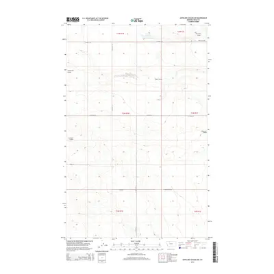
2014 Map of Antelope Coulee NW
USGS Topo · Published 2014About this map
Suphellen Reservoir sits at the northern edge of this high plains landscape in Toole County, where the topography is defined by a complex network of seasonal drainage channels. The area is marked by numerous coulees, including Fifteenmile Coulee, Taylor Coulee, and the eponymous Antelope Coulee, which weave through the section lines of the Public Land Survey System. These landforms reveal the erosional patterns characteristic of the Montana plains, providing vital drainage for the region's agricultural and ranching operations.
Find a feature on this map
20 named features on this map. Tap any name to fly to it.
Don’t see what you’re looking for? This feature index may not catch every label — zoom into the map to look around manually.
Map Details
Editions of this 2014 Antelope Coulee NW Map
This is the sole edition of this map. No revisions or reprints were ever made.
Other maps of this area

1939 · Sunburst
USGS Topo · 1:62,500

1943 · Antelope Coulee
USGS Topo · 1:62,500

1943 · Shelby
USGS Topo · 1:62,500

1945 · West Butte
USGS Topo · 1:62,500

1954 · Shelby
USGS Topo · 1:250,000

1958 · Shelby
USGS Topo · 1:250,000

1984 · Sweet Grass Hills
USGS Topo · 1:100,000
1986 · Antelope Coulee SW
USGS Topo · 1:24,000
1986 · Shelby
USGS Topo · 1:24,000
1986 · Ferdig
USGS Topo · 1:24,000